Galloway, a region in southwest Scotland steeped in history, has long captivated archaeologists and historians with its rich tapestry of prehistoric, Viking-age, and medieval sites. In 2025, advancements in archaeological visualization technologies, such as 3D modeling, drone photography, and ground-penetrating radar (GPR), are transforming how we explore and interpret Galloway’s ancient past. These cutting-edge tools are not only bringing long-buried sites to life but also reshaping our understanding of the region’s cultural and historical significance. This 2,000-word guide delves into the latest developments in archaeological visualizations in Galloway, highlighting key projects, their impact on research and public engagement, and the future of digital archaeology in the region.
The Power of Archaeological Visualization
Archaeological visualization encompasses a range of digital techniques used to reconstruct, analyze, and present ancient sites and artifacts. These methods include 3D modeling, virtual reality (VR), augmented reality (AR), photogrammetry, and geospatial mapping. Unlike traditional excavation, which can be invasive and time-consuming, visualization offers non-invasive ways to explore sites, preserve fragile remains, and share findings with a global audience.
In Galloway, where sites range from Neolithic cairns to Viking hoards, visualization is proving invaluable. The region’s rugged terrain and scattered settlements make comprehensive surveys challenging, but technologies like drones and GPR allow archaeologists to map sites with unprecedented precision. Meanwhile, 3D reconstructions make these discoveries accessible, enabling the public to “step back in time” and experience Galloway’s past as it might have looked thousands of years ago.
Key Archaeological Visualization Projects in Galloway, 2025
Several groundbreaking visualization projects in Galloway are making headlines in 2025, each shedding new light on the region’s history. Below, we explore the most significant initiatives, their methodologies, and their contributions to archaeology.
1. 3D Reconstruction of Boreland Chambered Cairn
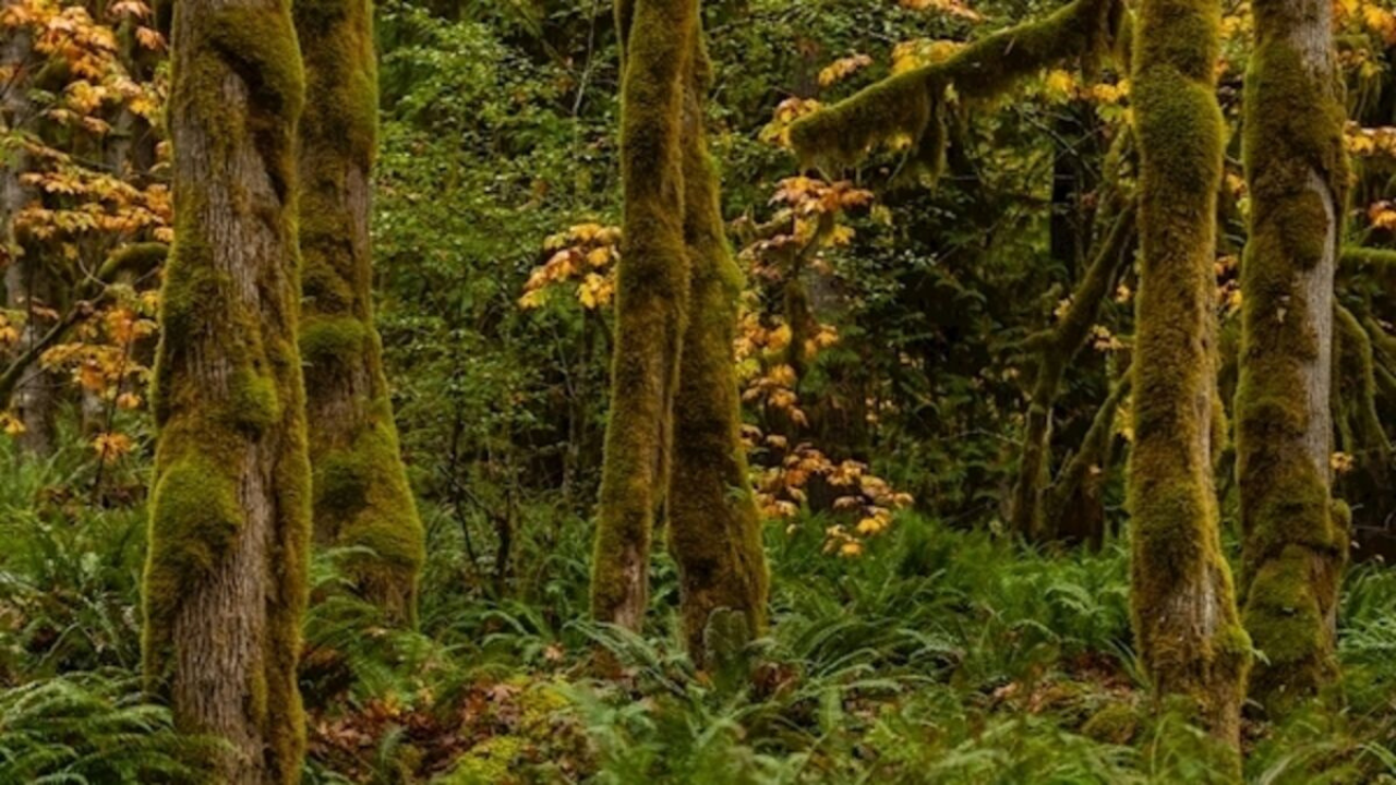
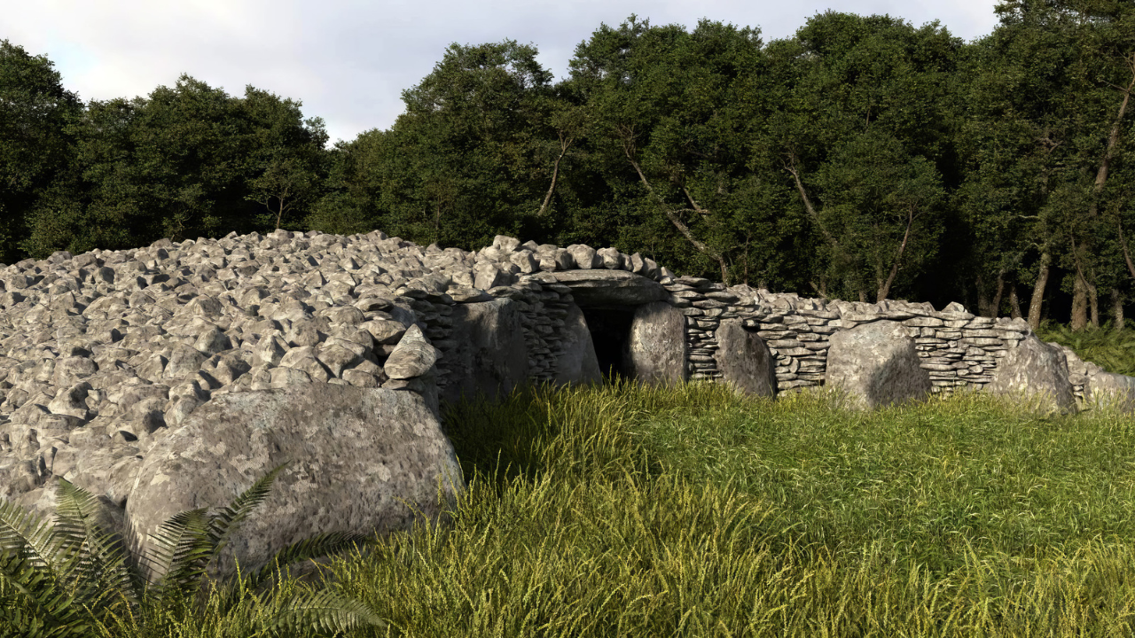
One of the most notable visualization projects in Galloway is the 3D reconstruction of the Boreland chambered cairn in Knockman Wood, north of Newton Stewart. This Neolithic tomb, built around 6,000 years ago by early farmers, is a Clyde Cairn—a type of burial structure characteristic of southwest Scotland. While the physical site is now a pile of stones, Forestry and Land Scotland (FLS) has used drone-based photogrammetry to create a vivid 3D model of how the cairn might have looked in its prime.
- Methodology: Hundreds of drone-captured photographs were processed using photogrammetry software to generate a high-resolution 3D model. This model reconstructs the cairn’s chambers, forecourt, and stone architecture, offering insights into its dual role as a tomb and a ceremonial space.
- Impact: The 3D model, accessible via an interpretation panel at the site and the FLS website, allows visitors to visualize the cairn’s original structure. FLS archaeologist Matt Ritchie notes that the visualization helps people “appreciate and understand” the site’s significance, bridging the gap between ancient communities and modern audiences.
- Public Engagement: The project has sparked local interest, with community groups and schools using the model in educational programs. It also highlights the potential of digital tools to preserve and promote Galloway’s Neolithic heritage.
2. Unwrapping the Galloway Hoard
The Galloway Hoard, discovered in 2014 near Kirkcudbright, is one of the most significant Viking-age finds in the UK, comprising over 100 artifacts, including silver, gold, and a rare Sasanian vessel. In 2025, the “Unwrapping the Galloway Hoard” project, led by National Museums Scotland (NMS) and the University of Glasgow, is leveraging advanced visualization techniques to study and share this treasure.
- Methodology: The project employs digital imaging, 3D reconstructions, and audiovisual displays to analyze fragile artifacts, such as textiles and inscribed arm rings. For instance, a runic inscription on a silver arm ring, translated as “this is the community’s wealth,” was revealed through high-resolution imaging, suggesting the hoard belonged to a collective rather than an individual.
- Impact: The use of 3D reconstructions has been critical for artifacts too delicate to travel, such as the hoard’s silk textiles. These digital models are featured in the international touring exhibition Treasures of the Viking Age: The Galloway Hoard, which debuted at the South Australian Museum in Adelaide from February to July 2025. The exhibition uses immersive displays to showcase the hoard’s global connections, from Anglo-Saxon England to the Sasanian Empire.
- Public Engagement: Audiovisual reconstructions have made the hoard accessible to a global audience, while the project’s research updates—shared at each exhibition stop—keep the public engaged with new discoveries. The planned permanent display in Kirkcudbright will further localize this narrative, connecting residents to their heritage.
3. Mapping the Prehistoric Heart of Galloway
The A75 bypass excavations near Dunragit, conducted by GUARD Archaeology between 2012 and 2013, uncovered evidence of 8,000 years of human activity, from Mesolithic camps to Neolithic monuments. In 2025, ongoing visualization efforts are digitizing these findings to create a comprehensive “Prehistoric Heart of Galloway” model.
- Methodology: GUARD Archaeology is using Geographic Information Systems (GIS) and 3D landscape modeling to map cropmarks, palisaded enclosures, and cursus monuments identified along the bypass route. Drone surveys and GPR have helped visualize subsurface features, such as post alignments and ceremonial structures, without further excavation.
- Impact: The digital model reveals Galloway as a hub of Neolithic activity, with one of the densest concentrations of oak post structures in Britain. This challenges assumptions about the region’s isolation, highlighting its role in far-reaching trade and cultural networks across the Irish Sea. The model also informs future conservation strategies, identifying areas at risk from erosion or development.
- Public Engagement: The project’s findings, published in a monograph and booklet, are being adapted into interactive online maps for public use. These tools allow users to explore Galloway’s prehistoric landscape virtually, fostering a deeper appreciation of its complexity.
4. Mull of Galloway Earthworks
The Mull of Galloway, a dramatic peninsula, is home to ancient earthwork fortifications at East and West Tarbet. Recent excavations by AOC Archaeology, part of the Rhins Revealed project, have used visualization to clarify the date and function of these enigmatic structures.
- Methodology: In 2023, AOC Archaeology employed GPR and drone-based photogrammetry to map the ramparts, which include a 3m-high western structure and a series of lower eastern banks and ditches. 3D models of the site, combined with erosion monitoring, have helped reconstruct the multi-phase construction process, revealing palisade fences and refurbished ditches.
- Impact: While radiocarbon dating remains challenging due to limited organic material, the visualizations suggest the earthworks date to the Iron Age or early medieval period. This supports theories that the Mull was a fortified stronghold, possibly linked to maritime trade or defense. The digital models are guiding targeted excavations to resolve lingering questions about the site’s chronology.
- Public Engagement: AOC Archaeology’s public talks and online videos, including one by Graeme Cavers, have shared the 3D models with local communities, encouraging volunteer participation in future digs. This outreach strengthens community ties to the site and promotes heritage tourism.
Technologies Driving Archaeological Visualization in Galloway
The success of these projects relies on a suite of advanced technologies, each tailored to Galloway’s unique archaeological challenges.
1. Photogrammetry
Photogrammetry, used at Boreland and the Galloway Hoard, involves stitching together hundreds of photographs to create detailed 3D models. Drones equipped with high-resolution cameras capture images from multiple angles, enabling precise reconstructions of sites and artifacts. This technique is cost-effective and non-invasive, making it ideal for fragile or remote locations.
2. Ground-Penetrating Radar (GPR)
GPR, employed at the Mull of Galloway and Dunragit, uses radar pulses to detect subsurface features like walls, ditches, or burials. In 2025, multichannel GPR systems with stepped-frequency waves are enhancing data density, allowing archaeologists to map entire sites in high-resolution 3D. This reduces the need for destructive excavations while providing comprehensive site overviews.
3. Geographic Information Systems (GIS)
GIS integrates spatial data from surveys, excavations, and historical records to create interactive maps and 3D landscapes. At Dunragit, GIS has been instrumental in visualizing cropmarks and post alignments, revealing patterns of settlement and ritual activity. These models are dynamic, allowing researchers to update them as new data emerges.
4. Virtual and Augmented Reality
While still emerging in Galloway, VR and AR hold immense potential. The Galloway Hoard exhibition uses VR-like audiovisual displays to immerse visitors in the Viking-age world, while future projects may incorporate AR apps to overlay reconstructions on physical sites, enhancing on-site experiences.
Impacts on Research and Understanding
These visualization projects are reshaping our understanding of Galloway’s past in several ways:
- New Interpretations: The Galloway Hoard’s runic inscriptions, revealed through digital imaging, challenge the notion that Viking-age wealth was solely elite-driven, suggesting communal ownership. Similarly, Dunragit’s digital models highlight Galloway’s role as a Neolithic cultural hub, connected to Ireland and beyond.
- Preservation: Non-invasive techniques like GPR and photogrammetry protect fragile sites from damage, ensuring their longevity for future study. This is critical for sites like Boreland, where physical remains are deteriorating.
- Interdisciplinary Collaboration: Projects like “Unwrapping the Galloway Hoard” combine archaeology, materials science, and digital humanities, fostering partnerships between NMS, universities, and international institutions.
Public Engagement and Heritage Tourism
Visualization is democratizing archaeology in Galloway, making it accessible to diverse audiences:
- Educational Outreach: Schools and community groups are using 3D models and online maps to learn about Galloway’s history, fostering a sense of pride and ownership.
- Tourism Boost: The Galloway Hoard exhibition and Boreland’s interpretation panel are drawing visitors, supporting local economies. The planned permanent display in Kirkcudbright will further enhance heritage tourism.
- Community Involvement: Volunteer opportunities, such as those at the Mull of Galloway, empower residents to contribute to archaeological research, strengthening community ties to their heritage.
Challenges and Future Directions
Despite their promise, visualization projects face challenges:
- Cost and Accessibility: Advanced technologies like GPR and VR require significant funding and expertise, which may limit their use in smaller projects.
- Data Interpretation: Visualizations are only as accurate as the data they’re based on. Misinterpretations or incomplete datasets can lead to misleading models.
- Preserving Authenticity: Overly polished reconstructions risk romanticizing the past, so archaeologists must balance aesthetics with historical accuracy.
Looking ahead, Galloway’s archaeological community is poised to embrace emerging technologies. Machine learning could enhance GPR data analysis, while AR apps could transform site visits into interactive experiences. Collaborative platforms, like those used in the Galloway Hoard project, will continue to connect global researchers, ensuring Galloway remains a focal point for digital archaeology.
Conclusion
In 2025, archaeological visualizations are breathing new life into Galloway’s ancient landscapes, from the Neolithic cairns of Boreland to the Viking treasures of the Galloway Hoard. By harnessing photogrammetry, GPR, GIS, and immersive displays, researchers are uncovering hidden stories, preserving fragile sites, and engaging communities in meaningful ways. These projects not only deepen our understanding of Galloway’s role in prehistoric and medieval networks but also position the region as a leader in digital archaeology.
As technology advances, Galloway’s archaeological visualizations will continue to evolve, offering richer insights and broader access to its heritage. Whether you’re a researcher, a local resident, or a curious visitor, these digital tools invite you to explore Galloway’s past with fresh eyes. So, dive into the 3D models, join a community dig, or visit the Galloway Hoard exhibition—and discover the region’s history in vivid, unforgettable detail.